Can I do this?
If you like to explore, can read a street map, and can walk, run, bike, wheelchair, skate, scoot, or skip for 90 minutes- then you can do a Street Scramble! Strollers and electric wheelchairs are ok for those that need them. If you can’t read a map, you can be on a team with someone who can. At Street Scramble, we strive to include everyone we can.
How it works
Checkpoints are circled on a map. Your goal is to find as many as you can within your chosen time limit! The most common time limits are 90 minutes or 3 hours.
MAP HANDOUT
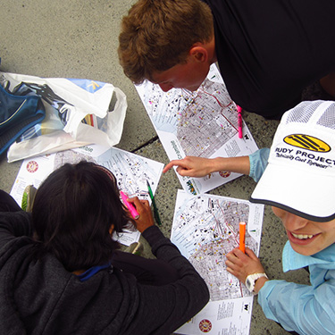
You will receive the map 30 minutes before the race start (time may vary), so that you (and your team if you have one) may plan which checkpoints you want to visit and your route between them. Checkpoints have varying point values. You can visit as many or as few checkpoints as you want, and in any order. Your team will need to stay together at all times. It is important to return to the finish on time, or you risk losing ten points for every minute or fraction of a minute that you are late!
TIP! Bring writing utensils to mark your route on your map!
POINTS
All points are rounded down to the tens. For example, checkpoint 39 is worth 30 points.
ANSWER SHEET
In addition to the map, you will also receive an answer-sheet (one per team). You’ll use this to show which checkpoints you’ve visited. The answer-sheet lists three things for each checkpoint:
- A feature to find
- A question
- Multiple-choice answers
When you think you’ve arrived at a checkpoint (they’re in the exact center of the circles on the map!), read the corresponding question and circle the correct multiple-choice answer according to what you see. Here’s an example:
Feature: Statue in yard
Question: What is the statue holding?
Possible answers: A) bird bath, B) basket, C) fish
Circle the correct answer to prove that you visited the checkpoint!
Remember that Street Scramble events are meant to encourage exploring, they are not ‘trivia’ events. Even if you think you may know or can look up the answer to a checkpoint question, please visit the checkpoint anyway, in the spirit of the event. Wrong answers receive a point penalty.
TIP! Some folks like to bring a clipboard with an extra clip so that you can attach the map to one side and the answer-sheet to the other!
THE START
Once the planning session is over, the race director will give a pre-race briefing to review the rules a few minutes before the posted start time. When it’s time to start the race, the race director will shout, “everybody… SCRAMBLE!!” and the race clock will begin as everyone goes dashing, wheeling, and walking in different directions!
IMPORTANT! Map Handout does not designate the start of the event. Even if you quickly finish planning your route, you may not leave the start area until the race director shouts, “everybody, SCRAMBLE!”
Now it’s time to enjoy finding checkpoints in parts of the neighborhood you’ve never seen before!
The Map
The map is usually based on a USGS topographical map. The map will have only a few street names on it, so it will be important for you to keep track of where you are by keeping your thumb on your location on the map and updating it as you move. Features that are relevant to pedestrian travel may be highlighted, such as trails, stairways, and bridges.
Because the USGS updates its maps infrequently, the map will not be completely up to date and you will see streets and buildings on the map that no longer exist– an interesting window into the past.
We are currently in the process of updating Street Scramble maps to be more up to date and easier to read. These maps are made in-house by Eric Bone, with available contour data, satellite photos, and field checking.
